Date:07/11/2011
Hikers:Frank, Matt, Me
Peaks:Dial Mountain (4020') (#41), Nippletop (4620') (#13)
Trailhead: St. Huberts Parking Lot, Ausable Club Trailhead
Trip Time:11 Hours (20-30 minute break on each summit including Bear Den Mt.)
As usual we left Albany at 5:30 with our goal of hiking Dial and Nippletop. I researched these two peaks for about a week or so to find the best way to approach them. Some people say going counter-clockwise and others say clockwise. Everyone said going down Elks Pass would be tough and it’s easier to go up it. So we decided to go clockwise, meaning we would travel down Elks Pass. The bonus of going this route is that our walk out would be down Lake Road for about 3 miles. We arrived at St. Huberts parking lot around 7:30, strapped on our gear and started walking down Ausable Club Rd to Lake Rd.
 |
| Matt, Frank, Me |
We got to the trail head at 8:00 and Frank signed us in at the registry. Lake Rd is well known for its Gate just past the registry.
 |
| Lake Rd Gate |
Twenty minutes down the road we reach the H.G. Leach Trail that we would hike to get up to Bear Den Mt. Climbing up H.G. trail to Bear Den was a reasonable climb. During our ascent Frank and Matt heard something in the woods and spotted a doe nearly 15 ft from us. With a few minor breaks for water and a snack we reached Bear Den at about 9:40.
 |
| Bear Den Mt. Summit |
After a nice 10 minute break taking in the views and having a small snack we ventured on. Our hike from Bear Den to the summit of Dial was a reasonable hike with an ascent of roughly 800 ft over 1.3 miles. At 10:30 we reached our 10th peak (double digits!). We soaked it in; this was our first view of the high peaks area from the Dix Wilderness area. The best part of the summit was that we were the only ones on it.
 |
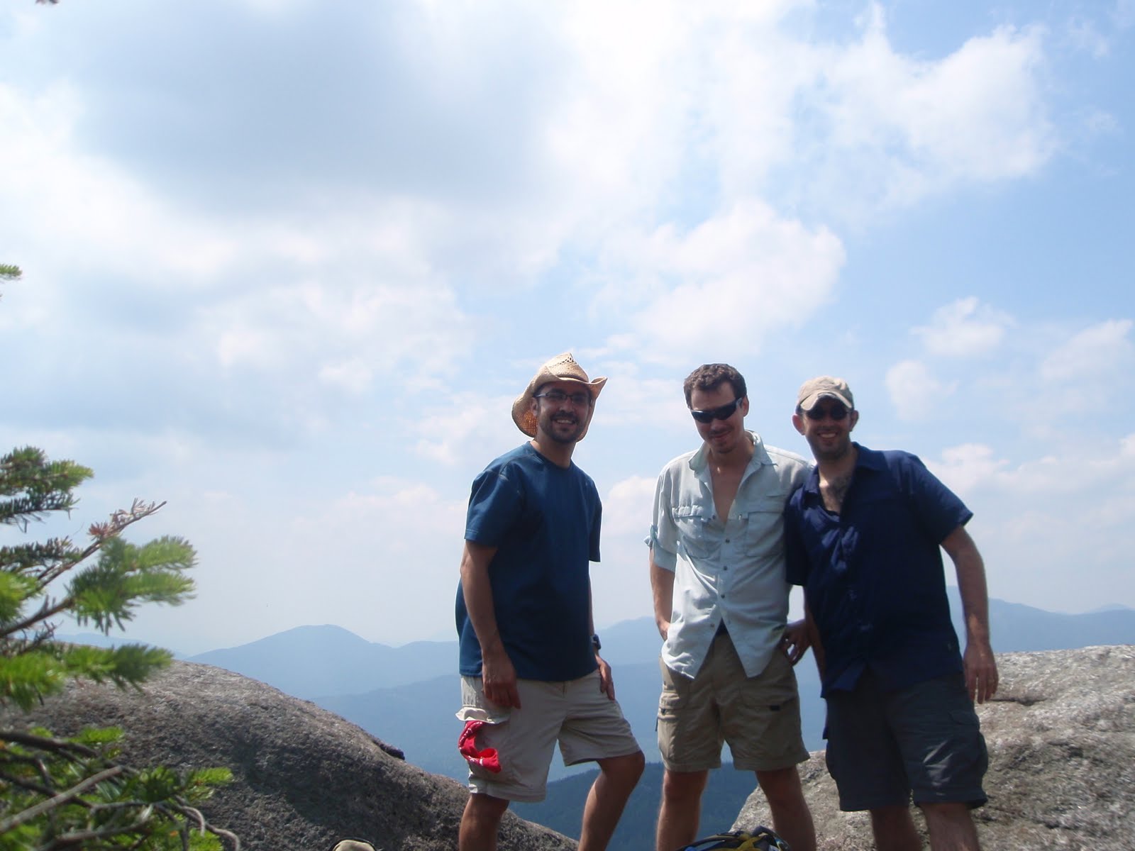
| Matt, Frank and Me on Dial Mountain Summit |
After about a 30 minute break we pressed on to Nippletop. I had a print out of how far we would be traveling throughout the hike, so we knew it was about 2.1 miles between the summits. We would be hiking along a ridgeline, which made the hike between summits very relaxing and gave us a chance to soak in random views here and there. We hit the summit of Nippletop around 1:45.
 |
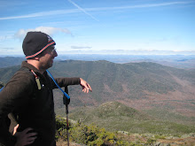
| Frank, Matt and Me on Nippletop Summit |
After another 30 minute break it was time to start our descent of Nippletop along Elks Pass. Elks Pass was a steep descent with a lot of rocks. During the descent we passed a group of people doing trail maintenance. This was the first time we saw people since the trail registry where a group of two guys were going out to hike Colvin and Blake. Right after we passed this group on Elk Pass, Frank slipped right on a rock w/ his tailbone breaking the fall. After a few slurs the pain started to fade a little but he would still be in pain for the remainder of the hike. Elks Pass was not fun at all, it just carried on forever.
 |
| Frank and Matt near Ausable Golf Course |
We reached the trail sign for Mt. Colvin around 4:00. We shortly reached a part in the trail where we could go left or travel the Gill Brook Trail. I just wanted to get to the road thinking it would be much faster. So we passed on the Gill Brook Trail and headed straight for the road. For what was a small trail seemed to take forever but we finally reached the road. I’m not going to go into much detail about the road but we have decided that for Mt. Colvin and Blake Peak we will travel the road first and then stay on the trail towards the end. Matt signed us out at 5:55 and we reached the car at 6:20. We finally got our first hike of the year in, took 3 months longer then we wanted but we made it!


There are some interesting cut-off dates in this article but I don’t know if I see all of them center to heart. There is some validity however I will take hold opinion till I look into it further. Good article , thanks and we would like more! Added to FeedBurner as well online gambling casino
ReplyDelete